ul. Firmowa 30, 05-152 Cząstków Polski
email: parker@parker.com.pl
Tel: +48 22 785 11 11
fax +48 22 785 09 99


Product categories:
- Engines
- Electric trolling motors
- Equipment and fittings for boats
- Navigation equipment
- Boats
- Parker Ribs
- Inflatable Boats
- Hovercrafts
- Morskie kaski ochronne GECKO
- JASON’S CRADLE
Our brands:


Certificates

RODO:
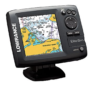

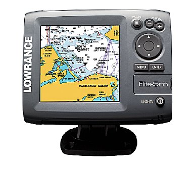
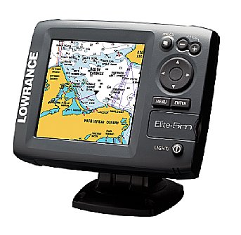
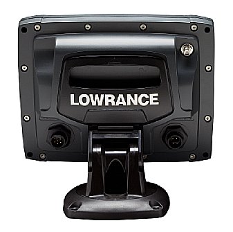
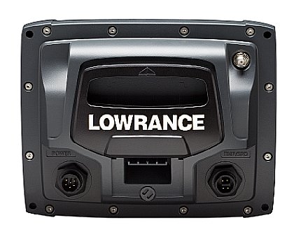

Elite-5m Gold
The new color Elite-5m Gold Chartplotter delivers high navigation performance and high color for your on-the-water journeys, and at a very affordable low price. All provide any boat with incredible precision and functionality, in addition to a spectacular new view.
This bundle includes a custom 2GB Navionics Gold micro SD card with Gold coastal/offshore coverage of US and Canadian waters along with coverage of the Great Lakes, Alaska, Hawaii, the Bahamas and over 125 major Canadian lakes.
The brilliant 5 in./12.7 cm, 480x480 pixel SolarMAX™ 256-color TFT
display has unmatched screen brightness, contrast, resolution and
viewing detail at wider angles and in bright sunlight. Adjustable screen
and keypad backlight improves usability and visibility day or night.
The internal 16-channel GPS antenna provides great WAAS+EGNOS+MSAS
precision for navigation. And an external antenna option is also
available for customized applications. A waterproof microSD memory card
slot is fully compatible with Fishing Hot Spots® Pro USA, LakeMaster®*,
and Navionics® mapcards in the micro SD format for U.S. anglers.
Built-in memory allows for up to 3,000 waypoints, 100 routes/100
waypoints per route and 100 retraceable plot trails/up to 10,000 points
per trail.
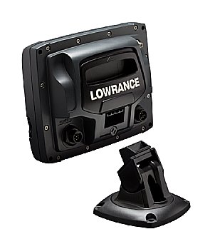
All of this, packaged with easy-to-use menus with Advanced Mode to expand features selection. An all-new case/mounting design provides for easy one-hand tilt/swivel view adjustment, removal and re-install - even fits same cut-out for previous 5 in./7 cm models for in-dash installations. And a new uniplug 1/4-turn connectors are compatible with earlier Lowrance uniplug installations to simplify upgrades to any new Elite model.
*Mapping cards available through LakeMaster Lake Map retail outlets.
The Navionics Gold Bundle cards include Navionics Gold data for Coastal US and Coastal Canada. These areas are all included on one custom card that Navionics makes specifically for us and only work in our Mark and Elite mapping units. A standard Navionics gold card can be purchased by region from a Navionics dealer in one of several regions.
DISPLAY
| Display Size | 5 in \ 127 mm |
| Display Resolution | 480x480 (H x W) |
| Display Type | 256-color SolarMAX™ PLUS TFT |
| Backlighting | Flourescent cold cathode |
| Backlighting Levels | Adjustable screen/keypad |
| Languages Supported | 23 |
GPS / NAVIGATION
| GPS Antenna Type | Internal high-sensitivity WAAS + EGNOS + MSAS (optional external antenna) |
| GPS Receiver Channels | 16 channels |
| Background Map | World reference basemap or (U.S. models) over 3,000 enhanced lake maps with depth contour and shoreline detail, plus coastal depth contours/shoreline detail and spot depth soundings to 1,000 ft./305 m |
| Custom Mapping |
Includes Navionics® Gold chartcards (U.S. Coastal and Canada Inland/Coastal). Optional Fishing Hot Spots® and LakeMaster®* mapcards (U.S.) in microSD format *Mapping cards available through LakeMaster Lake Map retail outlets. |
| Waypoint Storage | 3000 |
| Routes | 100 |
| Plot Trails | 100 retraceable plot trails/up to 10,000 points per trail |
| GPS Alarms | Yes |
NETWORKING / CONNECTORS
| NMEA Output | NMEA 0183 |
TECHNICAL / ENVIRONMENTAL
| Built-in Backup Memory | Yes |
| Waterproof Standard | Sealed and waterproof, suitable for saltwater use |
| Width | 6.9 in \ 174 mm |
| Height | 5.4 in \ 136 mm |
| Depth | 2.5 in \ 63 mm |
POWER
| Power Supply | 10-17 vDC |
OTHER
| Memory Card Capable | One (1) waterproof microSD card slot |