ul. Firmowa 30, 05-152 Cząstków Polski
email: parker@parker.com.pl
Tel: +48 22 785 11 11
fax +48 22 785 09 99


Product categories:
- Engines
- Electric trolling motors
- Equipment and fittings for boats
- Navigation equipment
- Boats
- Parker Ribs
- Inflatable Boats
- Hovercrafts
- Morskie kaski ochronne GECKO
- JASON’S CRADLE
Our brands:


Certificates

RODO:
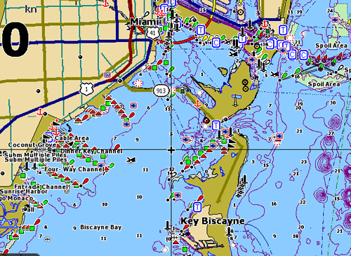

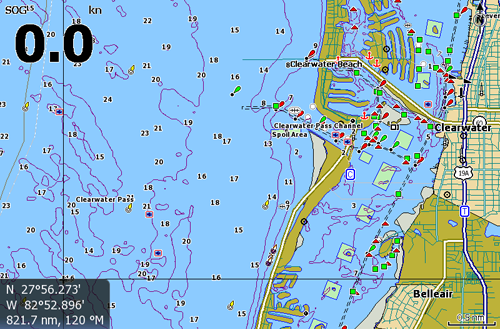
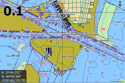
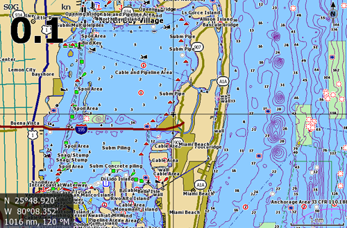

One card with same superb content as Nautic Insight HD, detail and coverage of U.S. coastal and offshore waters, but without shaded relief.
- Tides and currents
- Marked fishing areas and navigation aids
- Selectable on/off depth-contour option
- Loads of free space to save sonar & navigation data
- Expansive coverage U.S. coast and offshore
- NS Series compatible
A single chartcard with same superb content, detail and coverage of U.S. coastal and offshore waters, but without shaded relief overlay.
Insight 2012 includes hundreds of improvements to shoreline detail, updated navigation aids, and points-of-interest, plus significant software enhancements for higher performance and accuracy.
Detailed contour lines and coverage for offshore and coastal navigation, plus lake and river coverage up to 100 miles inshore. East and West – all on one chartcard; Maine through Texas for the East coast and Gulf of Mexico, California through Washington plus Hawaii for areas on the West coast.
User-selectable depth contour lines on/off
Coverage Info

Inshore/offshore coverage East Coast, West Coast and Hawaii, plus up to 100 miles inland.
West Coast Lake List- Coming soon!
East Coast Lake List- Coming soon!