ul. Firmowa 30, 05-152 Cząstków Polski
email: parker@parker.com.pl
Tel: +48 22 785 11 11
fax +48 22 785 09 99


Product categories:
- Engines
- Electric trolling motors
- Equipment and fittings for boats
- Navigation equipment
- Boats
- Parker Ribs
- Inflatable Boats
- Hovercrafts
- Morskie kaski ochronne GECKO
- JASON’S CRADLE
Our brands:


Certificates

RODO:


Navionics Platinum+
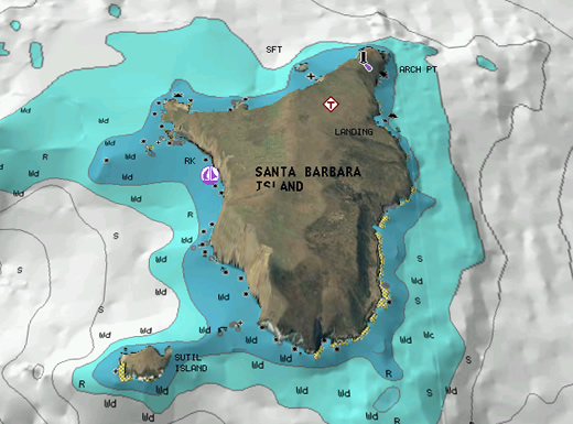
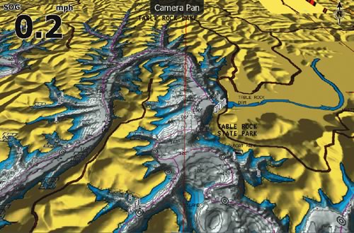
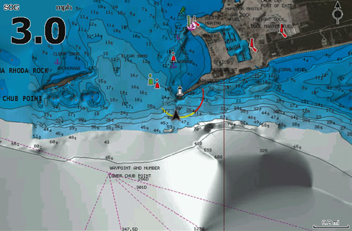
Multidimensional 3D Charting
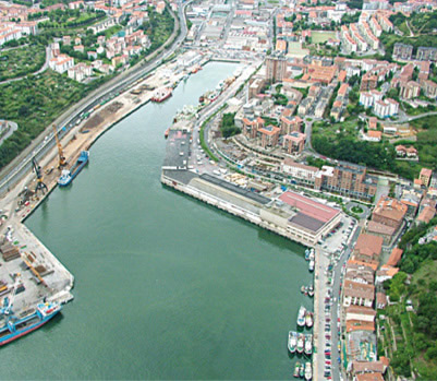
- Panoramic pictures
- 3D/2D views with satellite imagery
- Coast pilot guides
- POIs & built-in offshore fishing detail
Platinum+ charts offer the ultimate navigational experience with multidimensional 3D viewing, integrated aerial image overlay, bonus fishing detail, port photos and more. Compatible with all our NSS, NSE and NSO chartplotter / multifunction displays, Platinum+ is an optional upgrade that provides you with the highest level of navigational detail possible. Available with large, seamless coverage of up to an entire continent or for smaller, local areas (for boaters who don't venture far from their home port), there's a Platinum+ chart to suit your requirements. In 2D view the charts are instantly recognisable with similar detail to those found on a paper chart, and more. In 3D view the charts offer a more realistic experience, especially when combined with high resolution satellite image overlay, making landmarks instantly recognisable, enabling the navigator to assess the boat's position more readily.
These highly detailed 2D/3D charts can be easily loaded on to any of our NS series chartplotter / multifunction displays via the MicroSD or SD card slots, which also allows for fast and efficient free* updates.
*Gold and Platinum+ charts are eligible for one year of free updates to navigation aids and POI.